How Charles Sturt is creating connection across its communities
Across the City of Charles Sturt, thousands of new trees are being planted, neighbourhood streets are being redesigned, and a major cycling and walking path is steadily taking shape.
On the surface, the council’s Tree Canopy Improvement Strategy, construction of the Grange Lakes Corridor Shared Use Path, and the Renown Park Living Streets Project might seem like very different initiatives.
But when you consider Charles Sturt takes in Adelaide beachside suburbs like Henley, Grange and Semaphore Park but also dense inner western areas such as Findon and the fast-growing Woodville, the intent behind this work becomes clear: to create a more connected, greener city.
Not only for today’s residents – but for many generations to come.
That vision is perhaps most evident in the council's Tree Canopy Improvement Strategy, which sets an ambitious target of increasing tree canopy cover to 25 per cent by the year 2045.
To reach that goal – which was endorsed by elected members as part of the strategy a few years ago – Charles Sturt has doubled its annual tree planting program from around 3,000 trees a year to 6,000.
It’s a significant undertaking, the size of which isn’t lost on Project Lead Justin Figg – who started as an apprentice at the council more than 20 years ago.
“Everyone knew it was a bold target to achieve – but we’re confident we can hit it,” he says.
“Before we start planting, we map out our canopy cover, urban heat and potential planting opportunities, but it’s not until you go out and visit these sites in person that you can be fully clear about the planting space available.
"You've got underground services, you've got competing infrastructure in the verge, so to actually turn that from mapping on paperwork to what's actually practical in the field can be a different story."
Urban infill development across Charles Sturt continues to create challenges – where a former single home site can now become three or four dwellings, bringing additional driveways and reducing available verge space for new plantings.
It’s a theme many metropolitan councils are finding ways to navigate when it comes to increasing tree canopy – and for Charles Sturt, new technology is helping it win the battle.
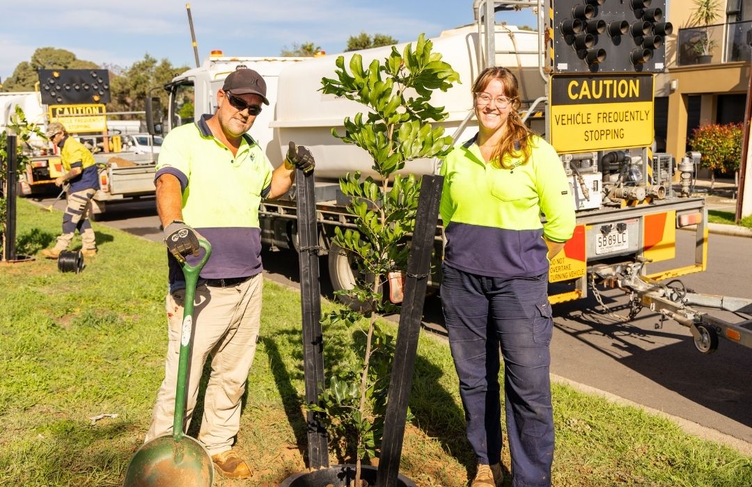
This year, the council became one of the first in South Australia to introduce ‘Tree Coach’ as part of its tree planting program.
Made from 100 per cent recycled e-waste, the reusable system supports newly planted trees during their establishment phase before being removed and used again elsewhere.
While still relatively new, the technology is already helping streamline the planting process for council staff and contractors.
"Field staff are speaking very highly of it," Justin says.
"It's reduced the labour side of installing or planting the tree and the integrated watering bowl directs water where it's needed most during summer – making it more efficient – while the consistent appearance creates a more uniform streetscape.
"We want our trees to thrive, not just survive – and using latest technology like Tree Coach is another way we can get an extra edge and meet our goals.”
Meanwhile, in the north-east part of the Charles Sturt catchment area, many of the same principles are taking shape through the council’s Renown Park Living Streets Project.
Developed through years of consultation with local residents, the project is being delivered in stages, with major upgrades to Wright and Bishop Streets nearing completion and Tait and Blight Streets included in the broader project area.
Reconstruction of road pavement, new concrete kerbs and gutters, asphalt resurfacing, landscaping and urban greening, and traffic calming and pedestrian safety upgrades are helping transform the streets into greener, more people-focused spaces.
City Infrastructure Project Lead Mike Blackie says Renown Park is a great example of how a road renewal project can do more than replace old infrastructure.
“We saw an opportunity to create greener, safer and more welcoming streets that better connect the neighbourhood,” he says.
“A big part of this project has been listening to the community and understanding how people move through and experience these streets every day.
“What makes this project special is that it brings together everyday infrastructure, community feedback, cultural storytelling and greener design.
“It shows how streets can be more than roads – they can help unite people and strengthen the character of a neighbourhood.”
This same integrated thinking underpins the council’s Grange Lakes Corridor Shared Use Path, which has been progressing in stages since 2014 and is creating a major active transport link through western Adelaide.
When complete, the corridor will stretch around 5.5 kilometres, connecting West Lakes with the River Torrens Linear Park and linking into the broader metropolitan cycling and walking network.
Stage 7 of 12 is currently underway from Marlborough Street to North Street and is supported by a $1 million contribution from the Federal Government's Active Travel Fund – with the remainder funded by council.
“It’s an important missing link in the broader cycling network and walking network that we can connect up and encourage more people to walk and cycle,” Transport Engineer Evan Woolford says.
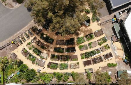
“It links two high schools, the Henley Art Society, the Henley Community garden, the Henley Beach and Grange precincts, and Henley and Grange Memorial Oval sports precinct.
“There are also cultural sites with fire pits and artwork linked to Kaurna culture that span the path.”
Community feedback strongly influenced the design of Stage 7, bringing residents directly into the planning process.
“We started off with a community ‘WALKshop’ where we came out to the site and walked with around 25 people from the community who were interested to get their opinions and thoughts about the project and anything they wanted to see,” Evan explains.
“There were lots of great ideas. A lot of people loved the idea of continuing the path because they could see that broader context.
“We had a lot of people requesting some green space to be left for playing. We also had requests for lighting to be biodiversity friendly – so it dims at night, but if you’re walking through it, it brightens up again.”
Because of potential flooding in the area, the council had to devise some creative solutions – including a boardwalk and ephemeral plantings, which can survive in both wet and dry conditions – to ensure the path functions in all conditions.
When complete, Evan expects it won’t be long until people walking, running and cycling start using the new stage.
“You can definitely see on the Strava app… as we finish each section, the heat map lights up after a few months,” he explains. “We know that if you build it, they will come.”
Whether it's planting 6,000 trees a year, redesigning neighbourhood streets or delivering a major shared-use path, the goal across the City of Charles Sturt is the same: creating public spaces that improve everyday life for residents and visitors.
As Evan puts it: "The creation of these new paths aren’t just about laying concrete. They genuinely improve the general health and wellbeing of the broader population in this area.
"And that's why we do what we do."